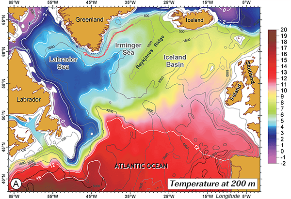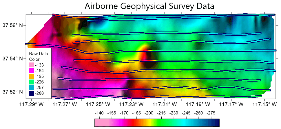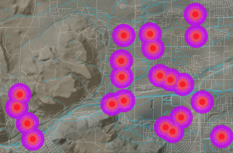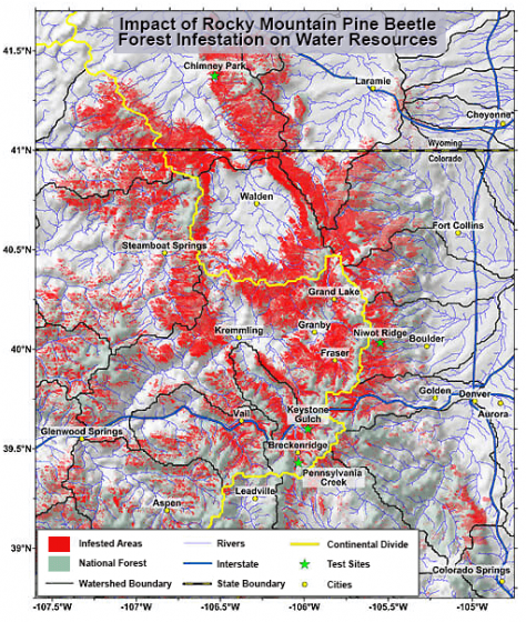

Surfer is a grid-based mapping program that interpolates irregularly spaced XYZ data into a regularly spaced grid. Grids may also be imported from other sources, such as the United States Geological Survey (USGS). The grid is used to produce different types of maps including contour, color relief, and 3D surface maps among others. Many gridding and mapping options are available allowing you to produce the map that best represents your data.
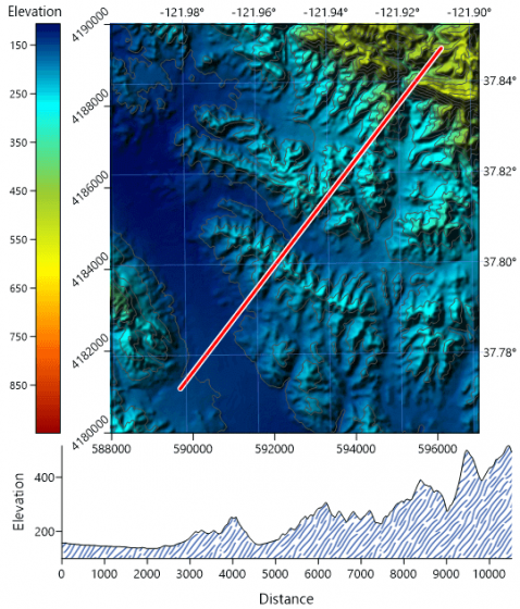
An extensive suite of gridding methods is available in Surfer. The variety of available methods provides different interpretations of your data, and allows you to choose the most appropriate method for your needs. In addition, data metrics allow you to map statistical information about your gridded data. Surface area, projected planar area, and volumetric calculations can be performed quickly in Surfer. Cross-sectional profiles can also be computed and exported.
The grid files can be edited, combined, filtered, sliced, queried, and mathematically transformed. For example, grids can be sliced to create cross-sectional profiles, or the Grids | Calculate | Isopach command can be used to create an isopach map from two grid files. Grids can be edited with an intuitive user interface in the grid editor.
| CREATE PROFESSIONAL MAPS
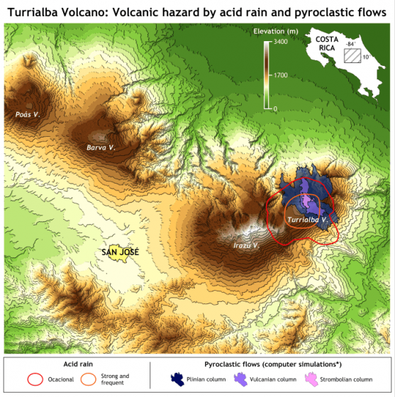
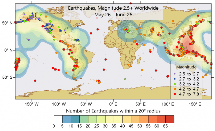
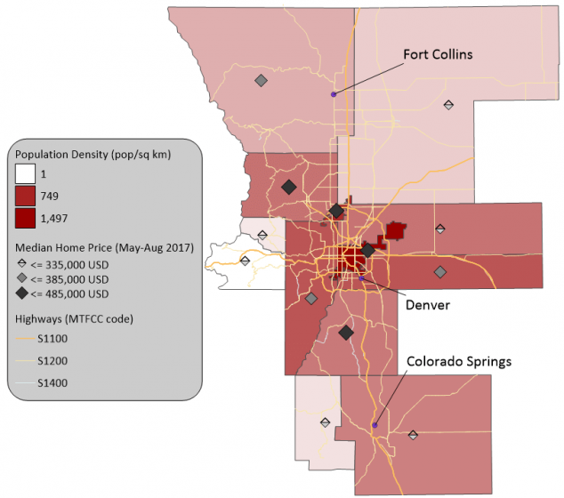
Easily communicate both simple and complex spatial data. Surfer gives you the tools to create high-quality maps to clearly deliver your message to coworkers, clients, and stakeholders.
SURFER MAP TYPES
Contour Base Post 3D Surface Color Relief Classed Post 3D Wireframe 1-Grid Vector 2-Grid Vector Watershed Grid Value Viewshed Point Cloud
MODEL DATA IN MULTI-DIMENSIONS
Gain deeper insights into your data when viewed in three-dimensional space. Surfer’s 3D viewer makes it easy to model, analyze, and understand all aspects of your data. Switching between Surfer’s 2D and 3D perspectives ensures you discover all of your data’s patterns and trends.
Achieve a 360° Perspective
View point data in true 3D space
LiDAR POINT CLOUDS
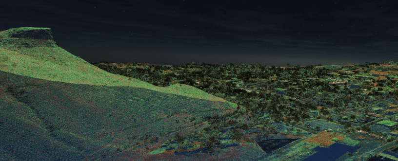
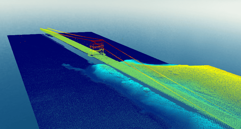
LiDAR is an increasingly popular data collection method used within many fields including archaeology, surveying, GIS, and more. Use Surfer’s extensive LiDAR processing and visualization features to take advantage of all that LiDAR has to offer.
Surfer’s LiDAR Point Cloud Features
Create a point cloud from multiple LAS/LAZ files Remove, reclassify or crop to selected points
Surfer’s LAS/LAZ Filtering Options
Spatial filtering based on XY bounds or elevation data limits
STREAMLINED WORKFLOWS
You will be up and running in matter of minutes. Surfer’s user interface was designed to take the guesswork out of learning a new program. We worked hard to streamline workflows so you don’t have to.
Surfer User Interface Features
Welcome dialog to get you started Contents window to easily manage layers of maps and models
ENHANCE MAPS & MODELS
Surfer gives you the tools to visualize and model all types of data, but it doesn’t stop there. Surfer’s extensive customization options allow you to convey complex ideas in an easy to understand manner. Enhance your maps and models with a variety of customizations options.
Surfer Customization Options
Add legends, cross sections, magnifiers, scale bars, and multiple axes Combine or stack multiple maps
FULL GRID CONTROL
Surfer gives you extensive control over grid files. Create isopach maps for structural geology, calculate volumes for inventory management or derivatives for terrain analysis, and even create site suitability models all with grid files. Achieve a complete understanding of your underlying data.
Surfer Grid Features
Directly edit the underlying grid data Project grids from one coordinate system to another
|
EDIT CONTOURS
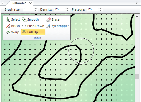
Edit contour lines down to the finest detail. Surfer’s grid editor lets you quickly adjust contour lines by interactively editing the underlying grid file. Brush, warp, smooth, push down or up, and erase grid nodes, and immediately see the changes to your grid-based maps.
Perform free-hand contour editing Warp contour lines
GRID DATA WITH CERTAINTY
Have complete confidence in the accuracy of your model. Surfer provides numerous interpolation methods to grid regularly or irregularly spaced data onto a grid or raster, and each interpolation method provides complete control over gridding parameters. Plus, no time is wasted with multithreaded gridding!
Surfer Gridding Methods
Kriging Local Polynomial
Surfer Interpolation Features
Variogram models Create grid files directly from contour polylines
MAKE MEANINGFUL DECISIONS
Get answers to your questions with Surfer’s geoprocessing tools. Process your data and analyze relationships. Narrow down areas of interest, highlight important intersections, or perform mathematical calculations on the underlying data to make informed decisions.
Surfer Geoprocessing Tools
View, create, edit and delete object attributes using the convenient Attribute Table Convert between polygons and polylines
Surfer Symbology
Apply line, fill, and symbol properties based on attribute values
IMMEDIATE ACCESS TO ONLINE DATA
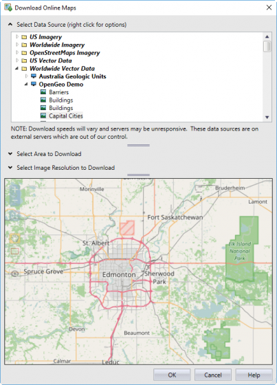
An abundance of data is at your fingertips waiting to be visualized. Surfer gives you immediate access to worldwide aerial imagery, Open Street Map imagery, worldwide vector data, and terrain data. If you have your own favorite data servers or access to a private data server, include a custom link to that source for easy access. Surfer makes it easy to access the surplus of online data. Supported server types:
Web mapping server (WMS)
WORK SEAMLESSLY WITH ALL COORDINATE SYSTEMS
Your job is to transform data into valuable visualizations. Surfer’s job is to make it easy for you. Surfer effortlessly manages unreferenced data and data projected in different/multiple coordinate systems. It really is that easy.
Surfer Coordinate System Features
Over 2500 predefined coordinate systems Over 80 ellipsoids
|
|
WHAT’S NEW IN SURFER? There are several new features in the latest release of Surfer! The top new features are listed below.
Top Features in Surfer’s Latest Release-
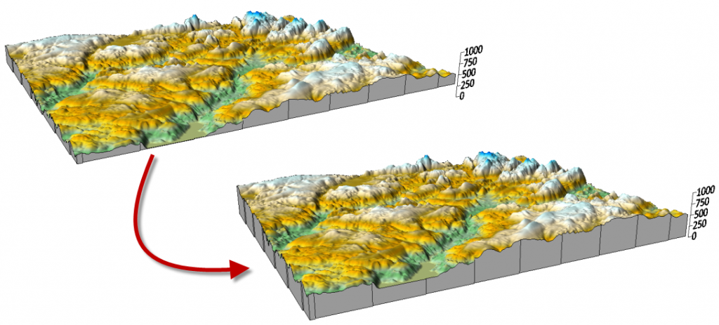
IMPROVED 3D SURFACE MAPS
New methods have been added to show the base on 3D surface layers. You can now select three different Z value settings to define to what Z value the base is shown. Previously, the base for the 3D surface layer filled the sides from the surface down to the minimum Z value of the grid file. Now you can select to show the base from the surface down to the minimum Z value in the map, to the minimum Z value in the grid, or to any Z value that you specify.
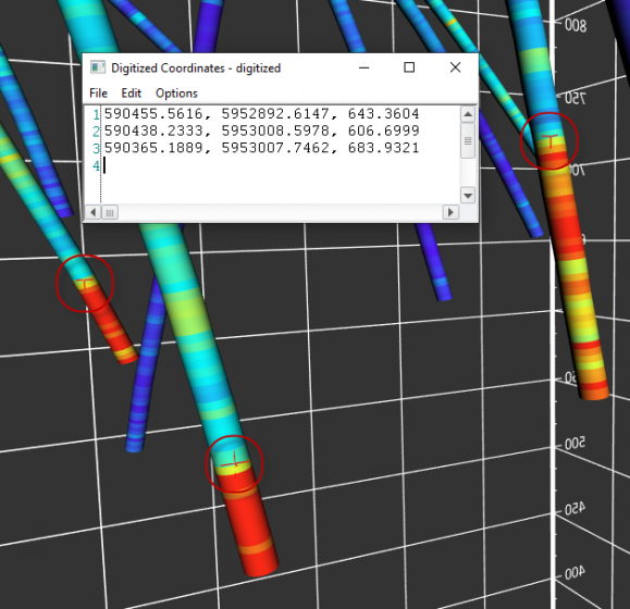
DIGITIZE IN 3D
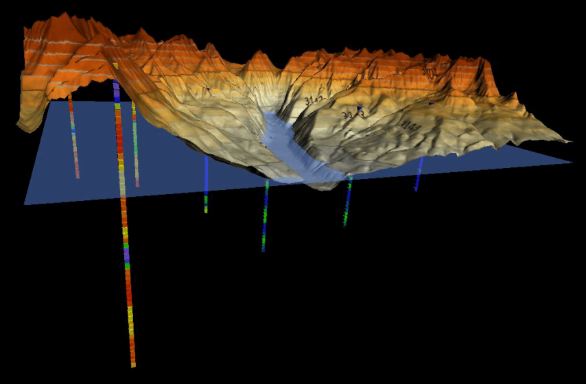
Before this new release, you could digitize your XY coordinates in 2D maps. Many of you use this feature to create blanking data. You can now perform the same type of digitization of data in the 3D view. 3D digitization collects XY and Z coordinates. Although you can use this new feature in a variety of functions, one function could be to obtain the XYZ coordinates of specific spot locations on a surface or points on subsurface drillhole paths.
This new feature works well with our new drillhole map. For example, when viewed in 3D, you can digitize specific locations at depth on each drillhole (e.g. the top of a unit or stratigraphic layer, determined by your displayed drillhole data). You can then go back to the 2D plot view, grid the digitized XYZ data, and add a contour layer from grid file to the existing drillhole map. The new surface will also be displayed in the 3D view with the drillhole paths!
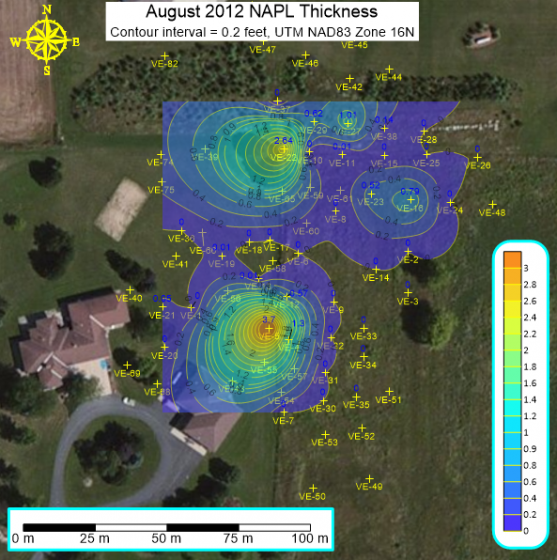
NEW FRAMES FOR COLOR SCALE BARS AND MAP SCALE BARS
We have added two important enhancements to the visual appeal and aesthetics of maps that you need to present to clients or peers. You can now add and customize a frame around color scale bars and map scale bars. You can set the margin between the frame and text in the scale bars and you can define its fill and line properties. This is very useful when overlaying the color or map scale bar on top of a filled map, such as an aerial photograph.
MORE HELP WITH COLOR SCALE BARS
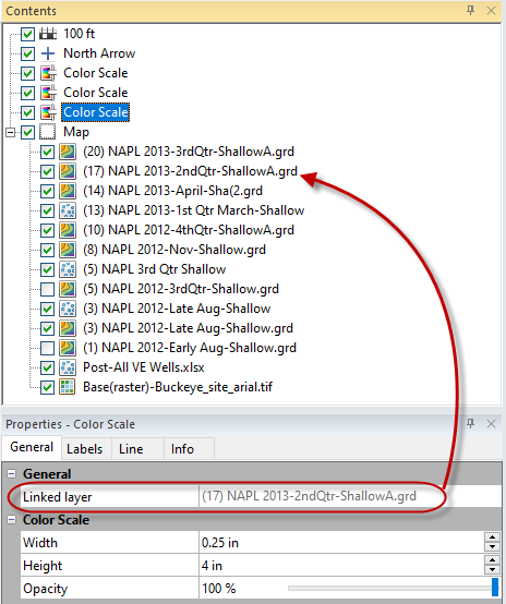
We know that many of you often build maps that have several layers and thus have several color scale bars. A new enhancement makes it easy for you to identify which layer a color scale bar belongs to. In the Contents window, click on one of the color scales and the name of the layer it is linked to is displayed in the Properties window.
|
MANAGE WARNING MESSAGES AND WARNING DEFAULT BEHAVIOR
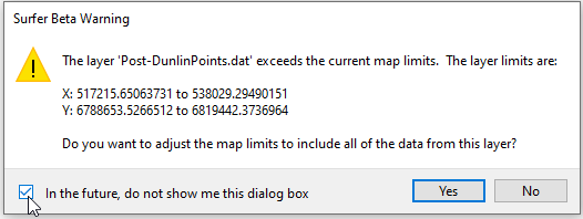
Because of Surfer’s flexibility, the application warns you when changes you make to maps may create unintended consequences. For example, Surfer issues a warning when adding new layers to maps when the added layers have data outside the current map limits. You are asked if you would like to adjust the map limits to include all the data, or keep the limits as they are. These warnings give you the option of cancelling out of the change or accepting the change and continuing.
Some of you perform routine tasks that trigger these types of warnings repeatedly, always with the same response. To save you time and headache, we have made several of these warnings optional. You can either choose not to show the warnings in the future directly in the warning itself, or you can use the File | Options command and control whether to display the warnings or not, or specify the default action to take.
SAVE A GRID AS A GEOTIFF
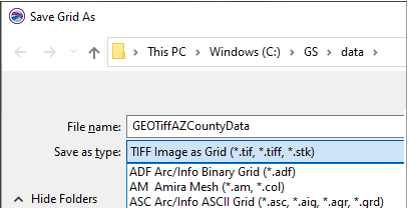
You could always export a map as an image TIFF, but now you can save a grid in GeoTIFF format, so that the Z values are saved to the TIFF file instead of colors for an image. Anywhere you can save a grid, you can select to save it in the TIFF Image as Grid format.
ENHANCEMENTS TO THE MAP WIZARD
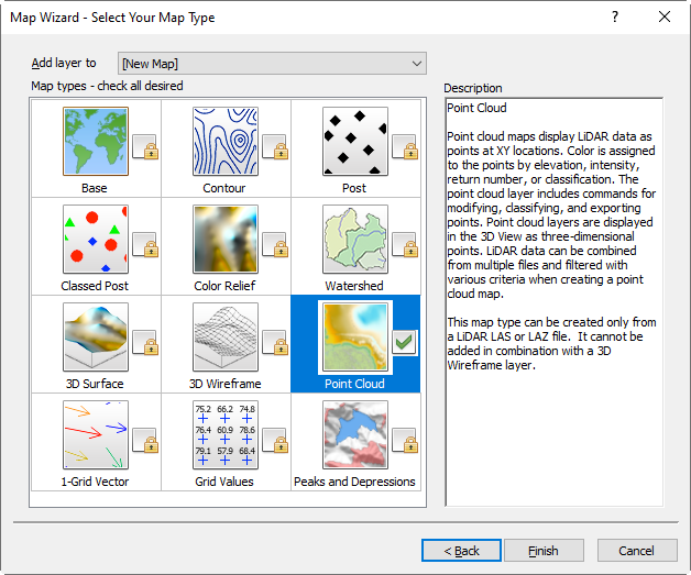
The Map Wizard has some new wizardry! We have added Point Cloud and Peaks and Depressions maps to the available map types you can create. These enhancements work the same way as creating other map types from the Map Wizard, simply select the Home | Wizard | Map Wizard command, select your data or grid file and click Next. Select the map types you want to create! Note that you can only select Point Cloud map type if you selected a LiDAR LAS or LAZ file in the previous step, and then selected to load it as a point cloud.
QUICK ACCESS TO GRID INFO
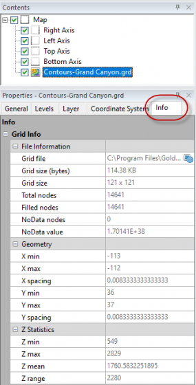
We created a quick way to access commonly used grid information, by including this information on the Info property page for any grid-based layer. These new Info page contains information about a grid file itself, its XY geometry, and some Z statistical information.
The Info properties page is a quick way to see information for any grid in the plot window or the active grid in the Grid Editor. Simply click on a grid layer and select the Info properties page to view the information. You can even click the Copy button to copy and then paste this information into the plot window, or another application.
|
END USER LICENSE AGREEMENT FOR GOLDEN SOFTWARE PRODUCTS
IMPORTANT-READ CAREFULLY
This Golden Software, LLC End-User License Agreement (“EULA”) is a legal agreement between you (either an individual or a single entity) (“LICENSEE”) and Golden Software, LLC for the received software product(s), which include(s) computer software and may include “online” or eleBy installing, copying, or otherwise using the SOFTWARE PRODUCT or any UPDATES (as defined below), you agree to be bound by the terms of this EULA. If you do not agree to the terms of this EULA, do not install, or use the SOFTWARE PRODUCT, and promptly return the entire unused SOFTWARE PRODUCT to your place of purchase for a full refund.
In addition, by installing, or otherwise using any updates or releases that you have received as part of the SOFTWARE PRODUCT (”UPDATES”), you agree to be bound by the additional license terms that accompany such UPDATES. If you do not agree to the additional license terms that accompanies such UPDATES, you may not install, or use such UPDATES.
SOFTWARE PRODUCT LICENSE
Copyright laws and international copyright treaties, as well as other intellectual property laws and treaties protect the SOFTWARE PRODUCT. The SOFTWARE PRODUCT is licensed, not sold. The SOFTWARE PRODUCT consists of product documentation, sample applications, tools and utilities, and miscellaneous technical information, (individually identified as “COMPONENT” and collectively as “COMPONENTS”). The rights regarding the COMPONENTS of the SOFTWARE PRODUCT are described below unless otherwise indicated.
GRANT OF LICENSE. Golden Software, LLC grants to LICENSEE a personal, nonexclusive, nontransferable license to install and use the SOFTWARE PRODUCT for which the applicable license fees have been paid.
COPY RESTRICTIONS. This SOFTWARE PRODUCT and the accompanying COMPONENTS are copyrighted. You may copy SOFTWARE PRODUCT in its entirety. You may not copy COMPONENTS separate from the SOFTWARE PRODUCT. All SOFTWARE PRODUCT copies must be complete and include the copyright notice. You may be held legally responsible for any copyright infringement that is caused or encouraged by your failure to abide by the terms of this EULA. You may make 1 personal copy of the printed materials accompanying the SOFTWARE PRODUCT or print copies of any user documentation for personal use by licensee only. All copies of printed materials or user documentation must include the copyright notice.
TERMS OF USE. In the following sections, “Affiliate” means any corporation, partnership or other entity (including a trust) directly or indirectly controlling, controlled by, or under common control with the LICENSEE (for the purposes of this definition “control” (including “controlling”, “controlled by” and “under common control with”) means the possession, directly or indirectly, of the power to direct or cause the direction of the management and policies of an entity (including a trust), whether through the ownership of voting securities or by contract or otherwise).
Single-User License. As the LICENSEE, you may use, or designate one individual within your organization or Affiliate organizations to install and use the SOFTWARE PRODUCT on a single computer. LICENSEE may permit the single authorized user to install a second copy for the end user’s exclusive use on a second computer as long as only 1 copy of SOFTWARE PRODUCT is in use at any time. You may access the registered version of the SOFTWARE PRODUCT through a network, provided that you have obtained individual licenses for the SOFTWARE PRODUCT covering all users that will access the software through the network. For instance, if four (4) different users access the SOFTWARE PRODUCT on the network, each user must have his/her own SOFTWARE PRODUCT license. A user can install and activate a single-user license up to the permitted number of activations provided they are the only individual accessing SOFTWARE PRODUCT. You may not distribute copies of the SOFTWARE PRODUCT to individuals outside your organization or Affiliate organizations. You may not modify, adapt, translate, reverse engineer, decompile, disassemble, or create derivative works based on the SOFTWARE PRODUCT. You may not modify, adapt, translate, or create derivative works based on the written materials without the prior written consent of Golden Software, LLC. Golden Software, LLC retains title and ownership of the SOFTWARE PRODUCT or any copy.
Concurrent-Use License. As the LICENSEE, individuals within your organization or Affiliate organizations may use SOFTWARE PRODUCT on computer(s) on a network, but the number of simultaneous users may not exceed the number of acquired license seats. You may not distribute copies of the SOFTWARE PRODUCT to individuals outside your organization or Affiliate organizations. You may not modify, adapt, translate, reverse engineer, decompile, disassemble, or create derivative works based on the SOFTWARE PRODUCT. You may not modify, adapt, translate, or create derivative works based on the written materials without the prior written consent of Golden Software, LLC. Golden Software, LLC retains title and ownership of the SOFTWARE PRODUCT or any copy.
Trial, Evaluation, and Beta License. SOFTWARE PRODUCTS acquired under a trial or evaluation license or subscription or under a beta testing program are intended for evaluation and testing purposes. Any such use is at LICENSEE’s own risk, and the SOFTWARE PRODUCTS do not qualify for Software Maintenance. If LICENSEE does not convert to a purchased license or subscription prior to the expiration of the evaluation term, LICENSEE may lose any customizations made during the evaluation term.
Educational Program License. LICENSEE agrees to use SOFTWARE PRODUCTS within the terms of the specific agreement between Golden Software and LICENSEE.
TRANSFER RESTRICTIONS. This SOFTWARE PRODUCT is licensed only to you, the LICENSEE, and may not be transferred to another entity without the prior written consent of Golden Software, LLC. Any unauthorized transferee of the SOFTWARE PRODUCT shall be bound by the terms and conditions of this EULA. Enabling others to use your product key(s), license string(s) or serial number(s) is strictly prohibited. In no event may you transfer, assign, rent, lease, sell, or otherwise dispose of the SOFTWARE PRODUCT on a temporary or permanent basis except as expressly provided herein.
TERMINATION. This EULA is effective until terminated. This EULA will terminate with notice from Golden Software, LLC if you fail to comply with any provision of this EULA. Upon termination you shall destroy the written materials and all copies of the SOFTWARE PRODUCT previously licensed to you.
UPDATES. Golden Software, LLC may create, from time to time, updated versions of the SOFTWARE PRODUCT. At its option, Golden Software, LLC will make such updates available to the LICENSEE.
SUPPORT SERVICES. Golden Software, LLC may provide you with support services related to the SOFTWARE PRODUCT (“Support Services”). Use of Support Services is governed by the Golden Software, LLC policies and programs described in the user manual, “online” documentation, and/or Golden Software, LLC provided materials. Any supplemental items provided to you as part of the Support Services shall be considered part of the SOFTWARE PRODUCT and subject to the terms and conditions of this EULA.
COPYRIGHT. All title and copyrights in and to the SOFTWARE PRODUCT, the accompanying printed materials, and any copies of the SOFTWARE PRODUCT, are owned by Golden Software, LLC. The SOFTWARE PRODUCT is protected by copyright laws and international treaty provisions. Therefore, you must treat the SOFTWARE PRODUCT like any other copyrighted material except that you may either (a) make one copy of the SOFTWARE PRODUCT solely for backup or archival purposes, or (b) install the SOFTWARE PRODUCT on a single computer provided you keep the original solely for backup or archival purposes. You may not copy the printed materials accompanying the SOFTWARE PRODUCT except as provided in Section 2 – COPY RESTRICTIONS.
UPDATE LICENSE TERMS. Additional license terms may accompany UPDATES. By installing, copying, or otherwise using any UPDATE, you agree to be bound by the terms accompanying each such UPDATE. If you do not agree to the additional EULA terms accompanying such UPDATES, do not install, or otherwise use such UPDATES.
EXPORT RESTRICTIONS. You agree that neither you nor your affiliates intend to or will, directly or indirectly, export or transmit the SOFTWARE PRODUCT or related documentation and technical data (or any part thereof), or your software application product to any country to which such export or transmission is restricted by any applicable U.S. regulation or statute, without the prior written consent, if required, of the Bureau of Export Administration of the U.S. Department of Commerce, or such other governmental entity as may have jurisdiction over such export or transmission.
U.S. GOVERNMENT RESTRICTED RIGHTS. The SOFTWARE PRODUCT is a commercial item, developed at private expense, provided to LICENSEE under this EULA. IF LICENSEE is a US government entity or US government contractor, Golden Software licenses LICENSEE in accordance with this EULA under FAR Subparts 12.211/12.212 or DFARS Subpart 227.7202. Manufacturer is Golden Software, LLC/809 14th Street/Golden, CO 80401-1866.
DISCLAIMER OF WARRANTY
NO WARRANTIES.
THE SOFTWARE PRODUCT IS PROVIDED “AS IS” WITHOUT WARRANTY OF ANY KIND. TO THE MAXIMUM EXTENT PERMITTED BY APPLICABLE LAW, GOLDEN SOFTWARE, LLC AND ITS SUPPLIERS DISCLAIM ALL WARRANTIES, EITHER EXPRESS OR IMPLIED, INCLUDING, BUT NOT LIMITED TO, IMPLIED WARRANTIES OF MERCHANTABILITY AND FITNESS FOR A PARTICULAR PURPOSE AND ANY WARRANTY AGAINST INFRINGEMENT, WITH REGARD TO THE SOFTWARE PRODUCT. THIS LIMITED WARRANTY GIVES YOU SPECIFIC LEGAL RIGHTS. YOU MAY HAVE OTHERS, WHICH VARY FROM STATE/JURISDICTION TO STATE/JURISDICTION.
INFRINGEMENT INDEMNITY.
Golden Software agrees to indemnify and hold harmless LICENSEE, its contractors, and its licensors, and their respective directors, officers, employees and agents from and against any and all claims and expenses, including reasonable attorneys’ fees, arising out of any third party action or threatened action brought against LICENSEE based on Golden Software’s violation misuse, misappropriation, or infringement of any Intellectual Property Right.
CUSTOMER REMEDIES.
WITH THE EXCEPTION OF INDEMNIFICATION OBLIGATIONS, GOLDEN SOFTWARE LLC’S ENTIRE LIABILITY AND YOUR EXCLUSIVE REMEDY SHALL NOT EXCEED THE PRICE PAID FOR THE SOFTWARE PRODUCT.
NO LIABILITY FOR DAMAGES.
TO THE MAXIMUM EXTENT PERMITTED BY APPLICABLE LAW, IN NO EVENT SHALL GOLDEN SOFTWARE, LLC OR ITS SUPPLIERS BE LIABLE FOR ANY DAMAGES WHATSOEVER (INCLUDING, WITHOUT LIMITATION, DAMAGES FOR LOSS OF BUSINESS PROFITS, BUSINESS INTERRUPTION, LOSS OF BUSINESS INFORMATION, OR ANY OTHER PECUNIARY LOSS) ARISING OUT OF THE USE OF OR INABILITY TO USE THIS GOLDEN SOFTWARE, LLC PRODUCT, EVEN IF GOLDEN SOFTWARE, LLC HAS BEEN ADVISED OF THE POSSIBILITY OF SUCH DAMAGES. BECAUSE SOME STATES/JURISDICTIONS DO NOT ALLOW THE EXCLUSION OR LIMITATION OF LIABILITY FOR CONSEQUENTIAL OR INCIDENTAL DAMAGES, THE ABOVE LIMITATION MAY NOT APPLY TO YOU.
Download the End User License Agreement in PDF Format
SYSTEM REQUIREMENTS
- Windows 10, 11, or higher
- 64-bit operating system
- 500 GB or larger hard-drive with at least 25% disk
- space available, or higher
- 16 GB RAM, or higher
- 3D View: Graphics card (e.g. NVIDIA, AMD, etc)
OPTIONAL SETTINGS
- Gridding, contouring, and color relief operations, all of which are heavily computational, are processor reliant and are multi-threaded. In Surfer, you will find a setting at File | Options | General | Max number of processors to use. It should be set to use all cores.
- For gridding and contouring operations, CPU performance is important. The more cores the better.
- When working consistently with very large data files, more RAM is important.
- Turning off auto recovery can help performance in some cases. It is OFF by default, but it can be enabled at File | Options | General | Save auto recovery information.
SURFER GUIDE
The Surfer Guide can be downloaded in pdf format here
©Copyright © 2025 Golden Software, LLC
Surfer is a full-function 3D visualization, contouring and surface modeling package that runs under Microsoft Windows. Surfer is used extensively for terrain modeling, bathymetric modeling, landscape visualization, surface analysis,contour mapping, watershed and 3D surface mapping, gridding, volumetrics, and much more.
